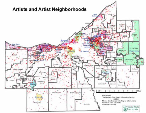
Where Are Artists?
The most basic way to understand the location decisions of artists is to see where they are currently living by pinpointing their current addresses on a map. The database of 4,016 individual artist addresses was used to geocode or map their locations. After completing this, Northern Ohio Data and Information Service (NODIS) and CPAC staff used a block group level map of the number of artists and artists per adult population (based on 2000 Census data), along with Geographic neighborhoods in the county.
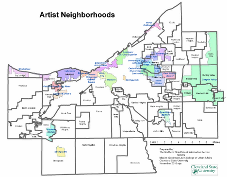
The twenty-four artists neighborhoods are listed below and shown in the following maps.
The map below shows artist neighborhoods colors are used to distinguish the neighborhoods.
The second map shows artists and artist neighborhoods. This map has red dots to show the areas that are most populated by artists.